           |
Kingdom
of Elleore - information webpage (unofficial)
|
| |
The many Facets of
Elleore Geography
The
geography of Elleore is not as constant and fixed as in most other
countries. The citizens only inhabit their homeland once a year for one
week. Therefore generation after generation does their best to add
to the wealth of geographic features and names, sometimes superseding
older notions and sometimes keeping them alive, even though the
background is no longer widely known.
The
following shows a number of Elleore maps. Working sometimes from
hardly readable photocopies I have tried to recreate the maps from all
eras of the Kingdom of Elleore as faithfully as I could. If you have
more information on some of the maps or can even provide me with dates
of issue, please contact me. The photocopies of the originals are also
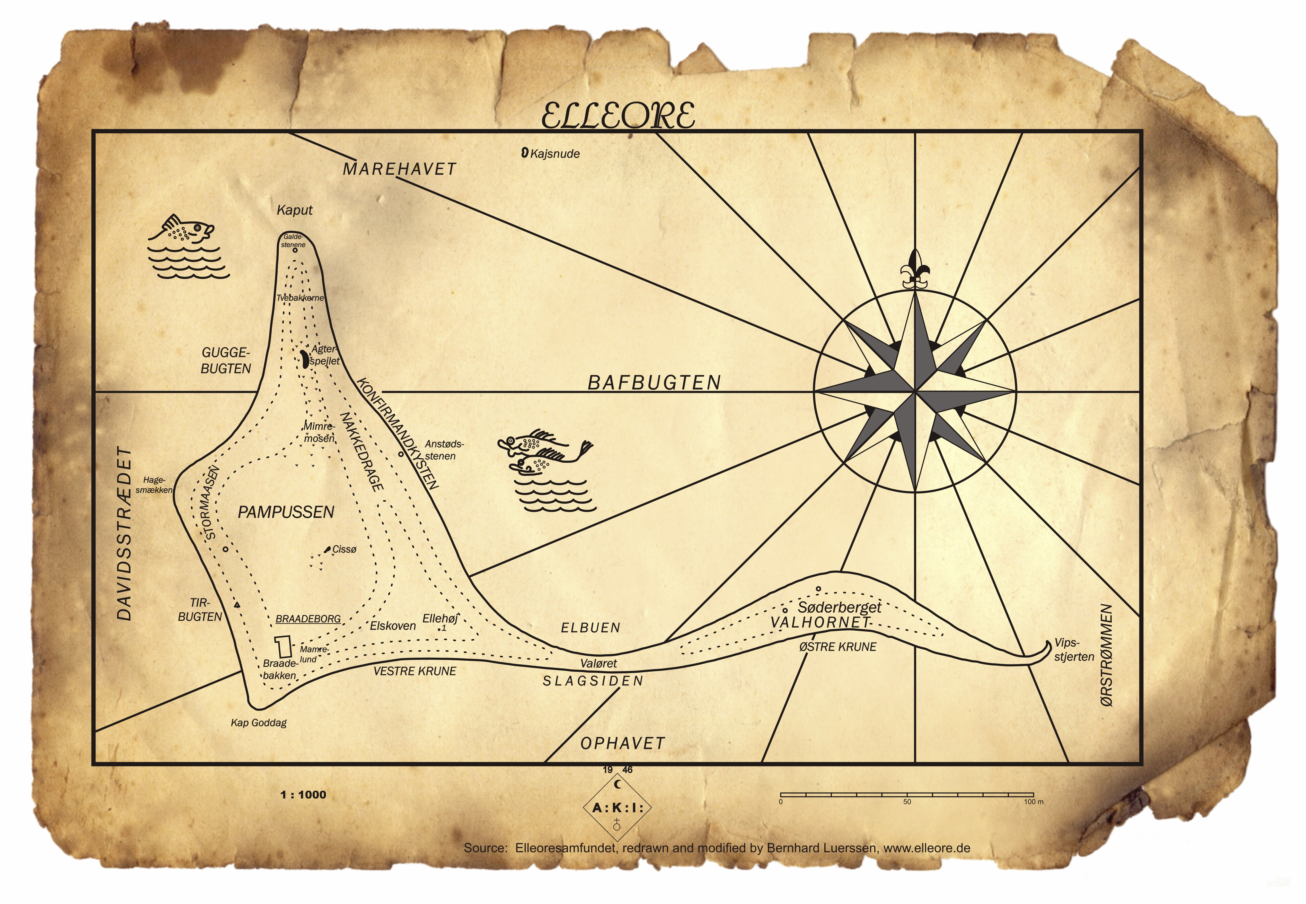
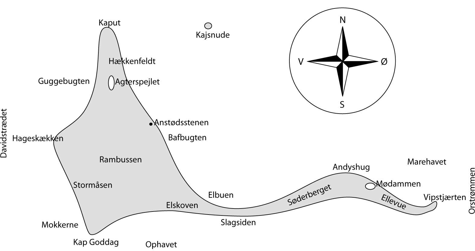
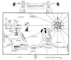
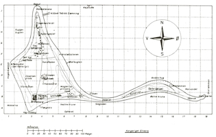
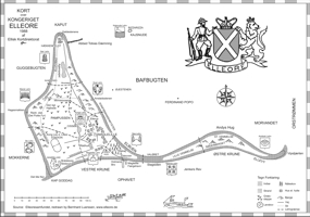
provided by kind permission of Elleoresamfundet. Maps of Elleore and my recreations of them: Map No. 01 - 1946: first AKI map, black&white, Scale 1:1000 This map
marks a departure from the depiction of detailed settlements as on Maps
Nos. 01 and 02. The topographic elevation is still indicated, but the
geographic features are distinctly fewer. A compass rose and a couple
of sea animals provide some ornamental detail. Original size is approx.
A3, and the map was created in 1946, as the "AKI" logo at the
bottom indicates. "AKI" stands for "Astronomisk Kartografisk Insitut"(Astronomical Cartographic Institute)
Note that nearly all the geographical features of this map remain unchanged to this day. The exception is the stretch of water at the eastern edge of the maps. Originally, "Ørstrømmen" referred to a teacher of that name at Frederik Barfods Skole. Over time, the knowledge of this connection was lost, and the name on later maps changed to "Orstrømmen" and occasionally "Ordstrømmen". |
 | 
| 
| | Recreated AKI map | Recreated AKI map with "treasure map" background | Copy of original - reproduced by kind permission
of former Elleore General Postal Director Rasmussen |
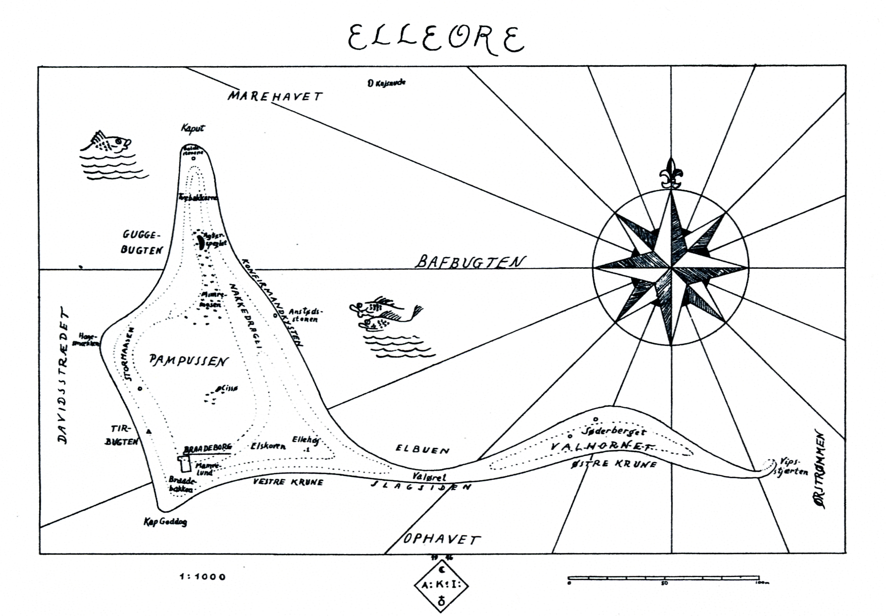
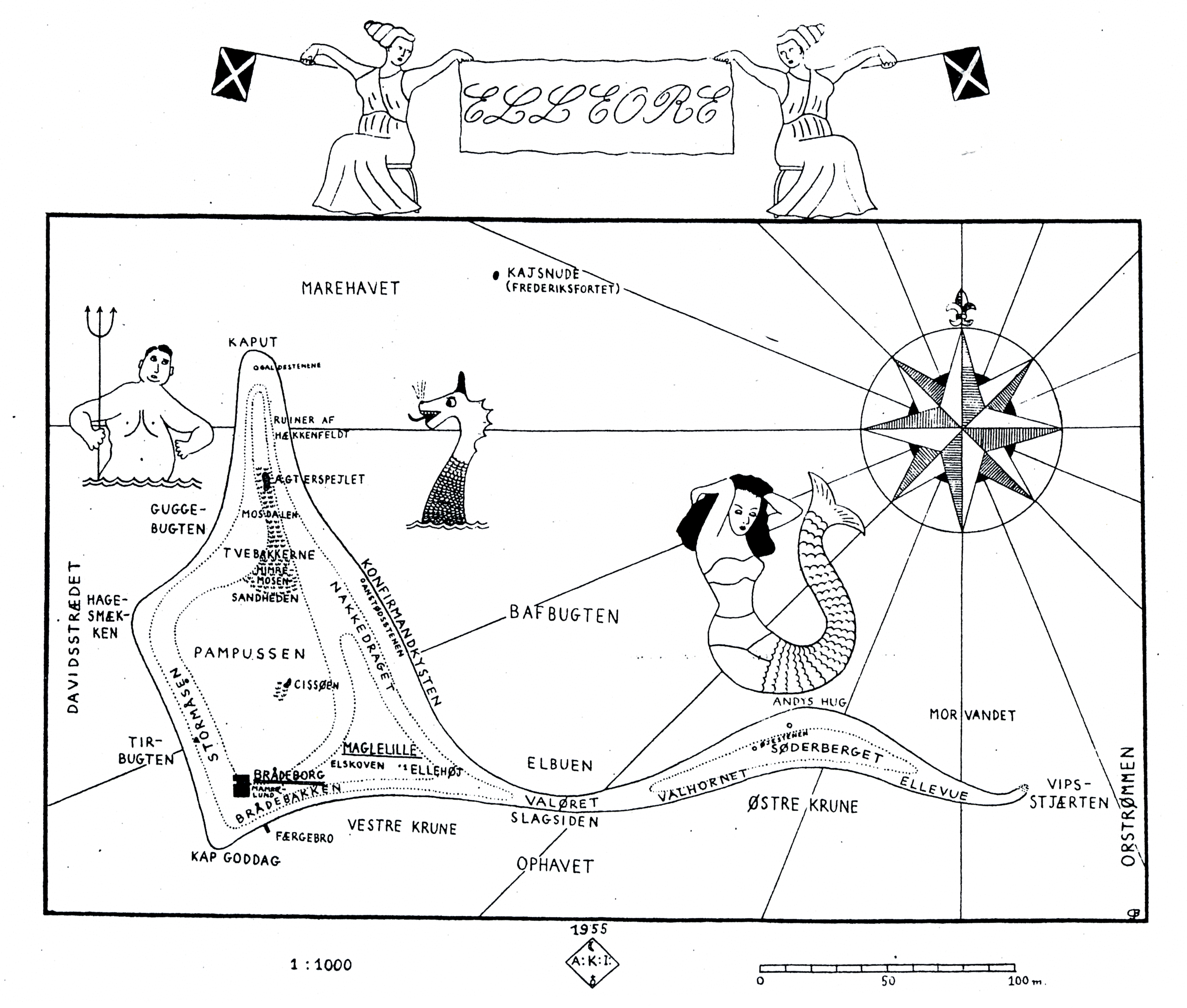
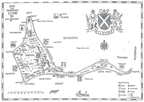
Map No. 02 - 1955: second AKI map, black&white, Scale 1:1000 This map
created a few years later retains basically all of Map No. 01, adding a
number of maritime fairytale decorations. Original size is approx.
A3, and the the map was created in 1955, as the "AKI" logo at the
bottom indicates. |
| 
| | Recreated ornamental AKI map | Copy of original - reproduced by kind permission
of former Elleore General Postal Director Rasmussen |
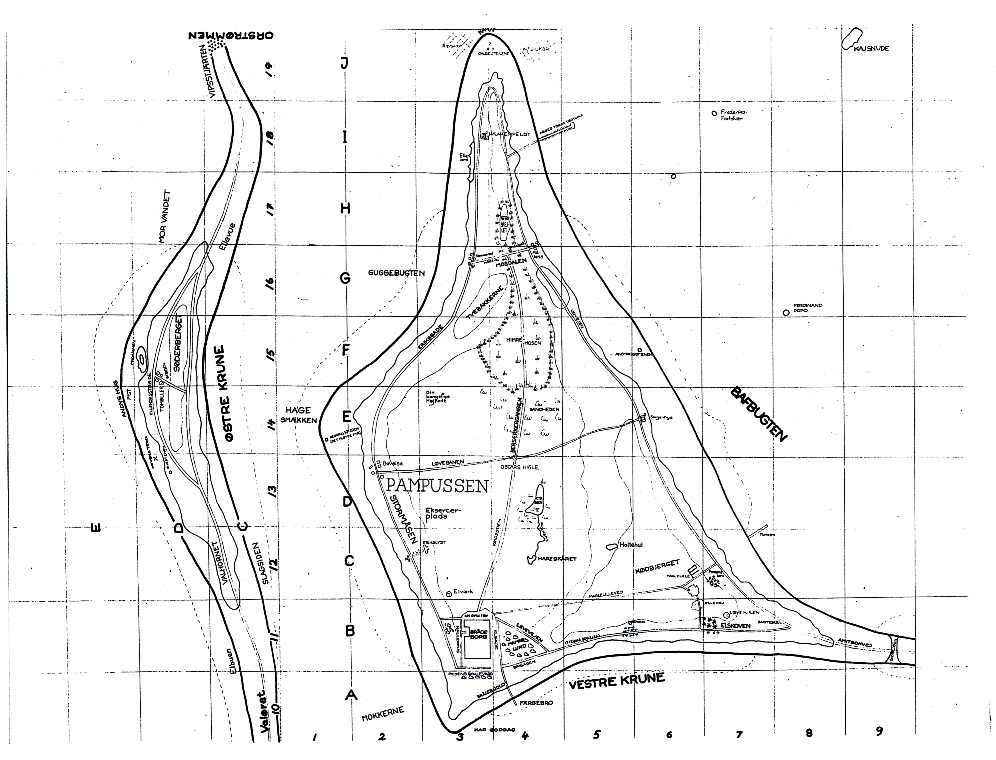
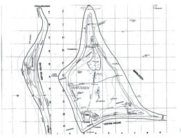
Map No. 03 - 1958: topographic map with coordinate grid, black&white, Scale 1:1000 This map
resembles closely Maps Nos. 01 and 02, but has a much more factual
appearance. Gone are sea serpents, mermaids, and fish. Instead, a
reference grid is added for the first time. Original size is approx.
A3, and the map may have been created in 1958, see somewhat
blurred note at bottom right on the original. |
| 
| | Recreated topographic map with coordinate grid | Copy of original - reproduced by kind permission
of former Elleore General Postal Director Rasmussen |
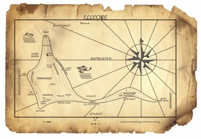
Map No. 04 - 1959 approx.: coloured wall map (I have no documented creation date) This
wall map was at times on display during the annual Court
Ball of Elleore. I estimate its original size to be roughly 1 m by 1 m.
It has two characteristics:
- the indication of the 8 Lehns (provinces) by numbers with a legend in the title field and
- little hamlets and many paths connecting them.
The
depiction of buildings and small groups of buildings is almost unique
to this map, only shared by the two-part map displayed next.
This
map gives the impression of depicting a much larger island, if one
takes the dimensions of typical houses into consideration. At a rough
guess, the depicted house sizes would point to an island stretching
approx. 3 km east-west, and 2 km north-south. |
| 
|  | | My recreation of the entire wall map | Photo of original - reproduced by kind permission
of Friherre Campi Deux af Ellerup | Black & white copy of original - reproduced by kind permission
of former Elleore General Postal Director Rasmussen |
Map No. 05 - 1959 approx.: two-part map, black&white (I have no documented creation date) No
information is available on original size and creation date. My
assumption is a creation date close to Map No. 04, as Map No. 05 shares
many of its features which never appear again in other maps.
Depicted houses, topographic elevation lines (representing 33 cm) and a
network of paths are among the most prominent.
Lehns are no longer mentioned and three offshore rocks are included as named features.
I have decided to join the two parts, although the original layout has a much more manageable format for paper printouts. |
 | 
| 
| | Both parts joined and colourized | Map recreated and colourized | Copy of original - reproduced by kind permission
of former Elleore General Postal Director Rasmussen |
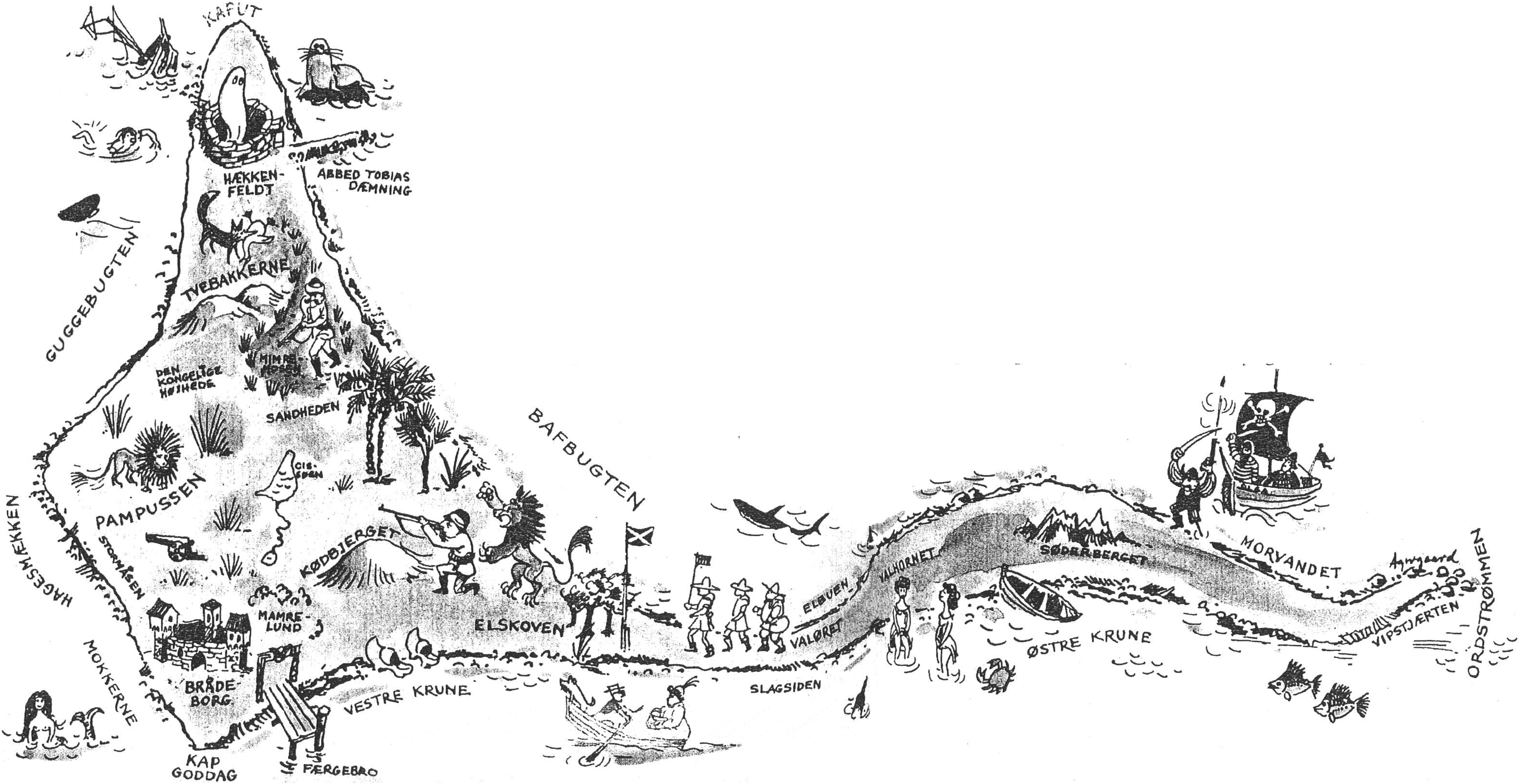
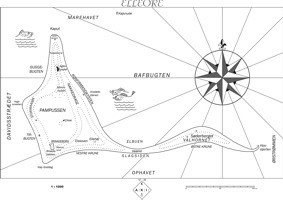
Map No. 06 - 1961: illustrative map from 'Samvirke', black&white This map
was taken from a double page in an article published in 'Samvirke'
issue no. 8, 1961. As it contains adventurous scenes including a ghost,
a deer hunter and pirates, it must be seen as a tongue-in-cheek
depiction of Elleore in conjunction with its history. The left edge of
the map clearly indicates that some text overlays the edge of the
drawing. Thus not the entire illustration is reproduced. I have
been trying to source
the original drawing, but so far without success. The artist's name in
the bottom right part reads "Agergaard" (probably). |
Still trying to source the original illustration...
| 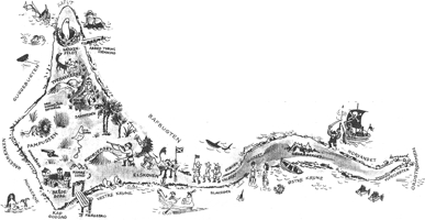
| | No recreation attempted so far. | Copy of original from newspaper article - 'Samvirke' no. 8, 1961 |
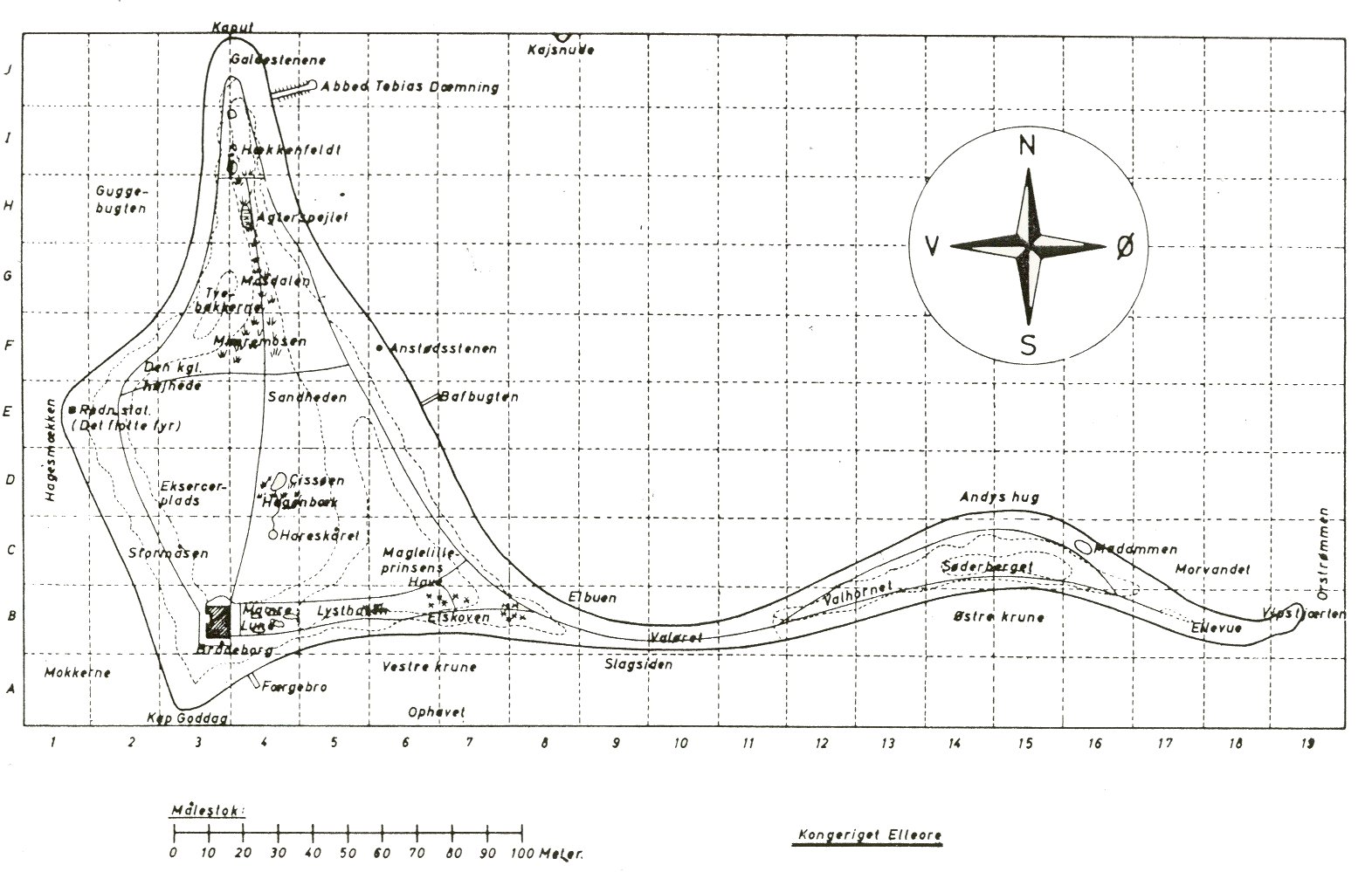
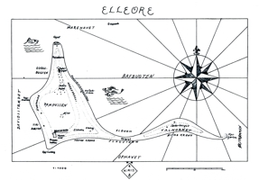
Map No. 07 - 1963: road map with grid, black&white, Scale 1:1000 Here
we have the return of the paths from Maps Nos. 04 and 05. However, the
settlements do not reappear. Like Map No. 03, this has a quite factual
appearance. A coordinate grid overlays the map, the border resembles a
technical drawing and a scale is included. Original size is approx.
A3, and the the map was created 5 July 1963, as marked at the bottom. |
 | 
| 
| | Recreated road map | Original - reproduced by kind permission
of former Elleore General Postal Director Rasmussen | Original - see www.elleore.dk |
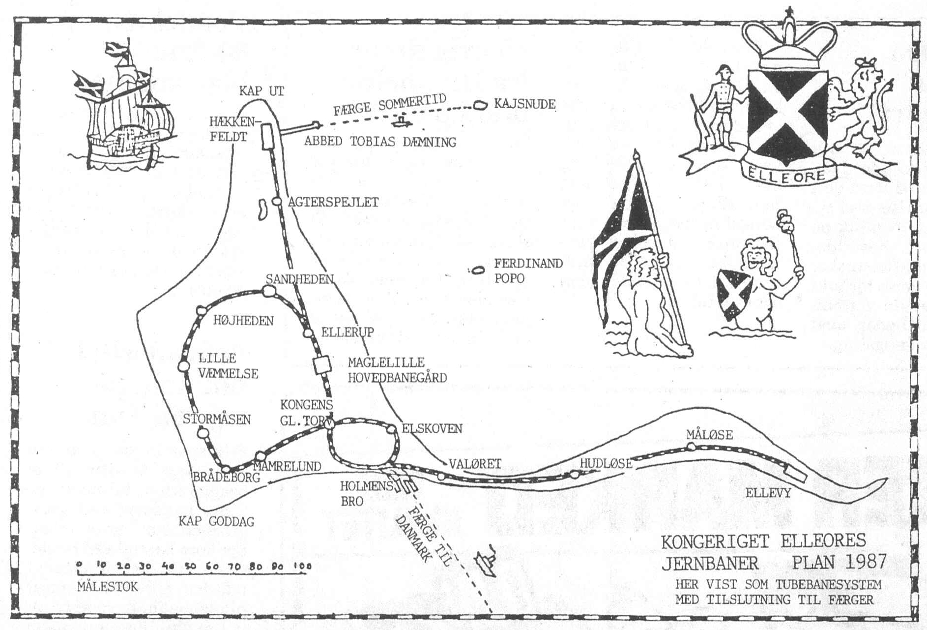
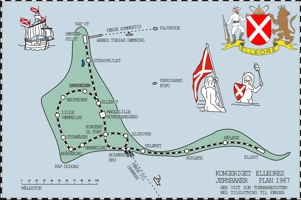
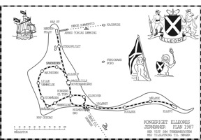
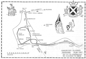
Map No. 08 - 1987: underground railway map, black&white After
a gap of 24 years, from which I have not been able to trace country
maps of Elleore, this
is the first thematic map of the collection. It was published as part
of a newspaper article by Aksel N. Bak on 5th august 1987. But the
map as such is quite obviously of Elleore origin. The accompanying
newspaper article provides a firmly tongue-in-cheek reasoning for an
underground railway system on Elleore. Apart from 'Lille Væmmelse' all
station names correspond to the geography of the era. The railway lines
are represented as main lines, and some decorations are scattered
at sea around the isle. I'm still trying to source the article, as I have only an unidentified photocopy. |
 | 
| 
| | Recreated and colourized underground railway map | Recreated underground railway map | Original, from Aksel Bakke's article |
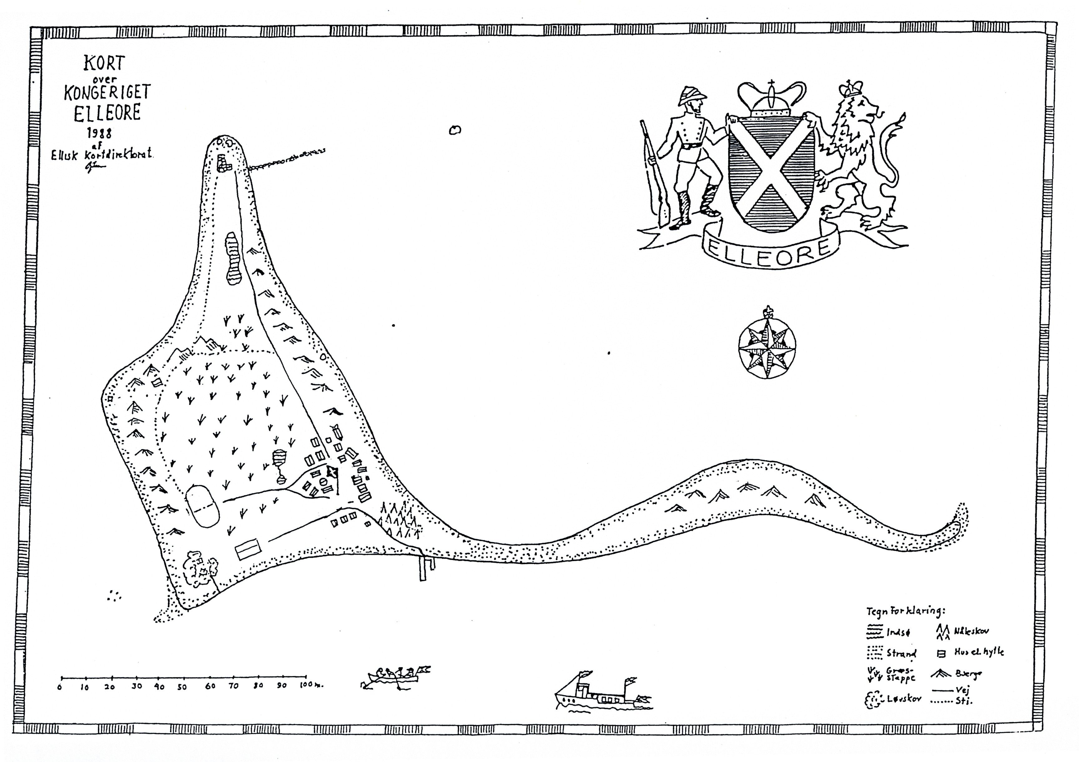
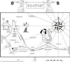
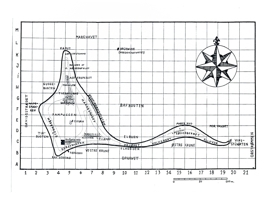
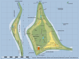
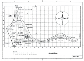
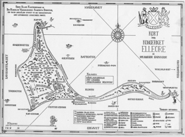
Map No. 09a & b - 1988: EKD topographic map with empty variant, black&white, Scale 1:1000 Very shortly after Map No. 08 this interesting pair of maps appeared on the scene. For
the first time since approx. 1959, the Lehns (provinces) are indicated by their
boundaries, their names and their coats of arms. Their number and
boundaries have changed. Kajsnude is now a separate Lehn, and some
others have swapped places. The coat of arms of each Lehn is depicted
here first on a map.
Topographic features are indicated in great
detail. Even a legend is included for them. 'EKD' stands for
Elleorisk Kortdirektorat (Elleorian Map Directorate).
Also for the
first time since 1945, single buildings (tents) are marked on the map.
This time, however, they are in accordance with the map scale.
Although
the only solid building on the isle, Brådeborg Castle, was demolished
in 1958, this map is the first to acknowledge its demise by marking the
spot 'Brådeborg Slotsruin'.
Original size is approx.
A3, and the map was created in 1988, as the title indicates.
This
map exists also as an 'empty' variant. This may have had teaching
reasons, sort of an exercise sheet for students of Elleore geography.
But that is pure speculation. |
| 
| | Recreated EKD topographic map | Copy of original - reproduced by kind permission
of former Elleore General Postal Director Rasmussen |  |  | | Recreated empty EKD topographic map | Copy of original - reproduced by kind permission
of former Elleore General Postal Director Rasmussen |
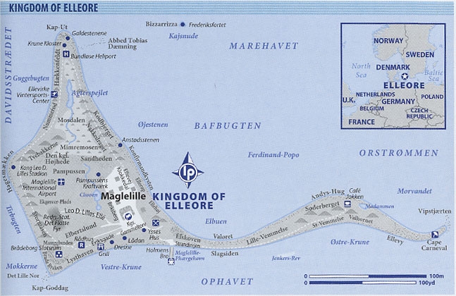
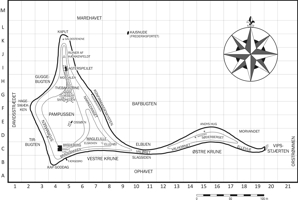
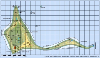
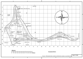
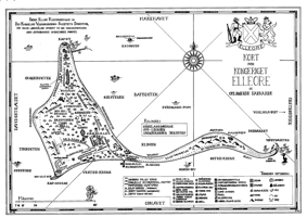
Map No. 10a & b - 1993: detailed topographic map (2 versions), black&white, Scale 1:1000 This
map, which is also shown on the home page of elleore.dk, is related to
Map No. 09. It leaves administrative data like Lehns out, replacing it
by a
few new geographic names as well as the location of single tents. The
multitude of items marked on the map necessitates a large legend in the
bottom right part.
Some of the features seem to refer
to 1993 in particular. The location of the tents with special functions
within Maglelille is not the same each year.
Original size is approx.
A3, and the map was created in 1993, marked as revision B.
This
map exists in two nearly identical versions. They are presented here
under the assumption that version b came later, because it includes
additional features. |
| 
| Detailed map - version a
copy of original - reproduced by kind permission
of former Elleore General Postal Director Rasmussen | Detailed map - version b - see also www.elleore.dk
copy of original - reproduced by kind permission
of former Elleore General Postal Director Rasmussen |  |  | | Recreated and colourized map version b | Recreated map version b |
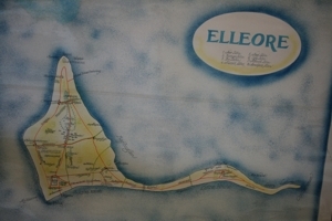
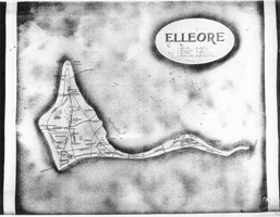
Other maps of Elleore:
Maps from other sources Finally, here are two maps from different sources.
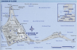
The left map is included in the Lonely Planet book "Micronations" published in 2006.
(Note that 'Det Flotte Fyr' and 'Kong Leo D. Lilles Stadium' have erroneously swapped locations.)
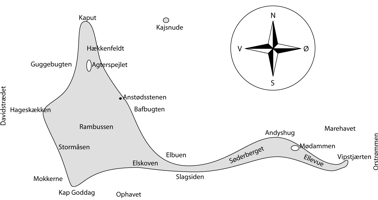
The right map appeared in the newsletter of the Roskilde rowing club 'Roskilde roeren' of July 2007.
(Note that 'Hageskækken' should read 'Hagesmækken'.) |
| 
| | From
'Micronations - The Lonely Planets Guide to Home-Made Nations' by
John Ryan, George Dunford and Simon Sellers. Available here | From 'Roskilde roeren' Volume 63, No. 3 of July 2007, pages 14&15, see here |
Last modified: 04 July
2015
|
 |
|
|